Storm Gerrit to Batter Cumbria with Gales and Rain on Wednesday
Storm Gerrit has been named by the Met Office, with several yellow weather warnings in force from Wednesday including two covering Cumbria.
A severe storm named by the Met Office as Storm Gerrit is set to batter the UK with snow, heavy rain and gales on Wednesday and early Thursday, following a mild Christmas Day and Boxing Day for most areas.
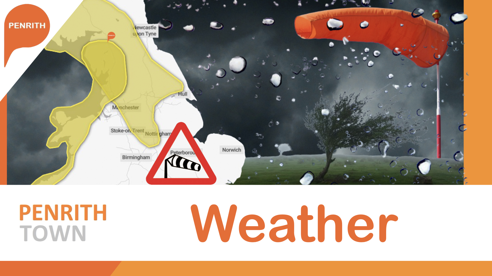
Cumbria is now covered by two separate yellow weather warnings one for strong gale force winds and a second for heavy rain.
Heavy rain weather warning is in place from 3am Wednesday 27th December until 6pm Wednesday evening.
The Gale force Winds weather warning is in place from 6pm Wednesday 27th December until 3am Thursday 28th December.
A number of further yellow weather warnings have been issued by the Met Office across the UK, with the potential to be updated as details firm up and the storm moves in.
Wind warning areas can expect gusts of 50-60mph, with up to 70mph on high ground and exposed coasts.
Rain in the warning areas is forecast to be between 40-60mm, with the potential for 70-90mm in the western hills of Wales and Cumbria and the North Wests along the western side of the Pennines.
Winds will be strong, possibly peaking around 70 mph on exposed coastlines, but more widely around 50-60 mph within the warning area.
Met Office Chief Meteorologist Frank Saunders said: “Storm Gerrit will run towards western UK on Wednesday and bring with it potential impacts for much of the UK.
“Rain is an additional hazard from Storm Gerrit, with active weather fronts leading to a wet day for many. Snow is also likely to cause problems for some northern areas: only briefly for a few upland routes across the Pennines and southern Scotland overnight and early on Wednesday, but more widely to the north of the Central Lowlands later in the day. Here around 10 to possibly 20cm of snow may affect some of the highest routes, this combining with very strong winds to lead to some difficult travel conditions. At lower levels a combination of heavy rain and very strong winds will dominate.”
Storm Gerrit will transition gradually to the northeast late on Wednesday and into Thursday. Further unsettled weather is likely later in the week, with strong winds, rain and some upland snow.
Met Office warnings highlight the possibility for transport disruption, power cuts and flooding in some areas so it’s important to stay up to date with the latest warnings.
We will bring you the latest updates from the Met Office here on Penrith.Town as Storm Gerrit makes landfall this evening with the potential for winds of 60mph as the storm front arrives late evening on Boxing Day.


 Then select "Add to Home Screen"